Adventures in Boating: Navigating the Florida Intracoastal Waterway
Nicknamed The Ditch, the ICW is a sheltered stretch of waterway. It officially starts near Boston, but most boaters use Norfolk, Virginia (mile marker 0), as the starting or ending point along the East Coast. The full length is about 3,000 miles and ends at Brownsville, Texas near the Mexican border. Today, we’re going to talk about the Florida section.
Made up of canals, inlets, saltwater rivers and bays, the ICW is a sheltered and protected way to travel due to the proximity to land, canals, marinas, fuel docks and private boat slips for rent. You don’t have to stress over traveling out into the open ocean for extended periods of time. Boaters navigating the Great Loop are familiar with the convenience and protection of the ICW. A large number of snowbirds use the waterway to get to private boat slips for rent and winter vacation homes.
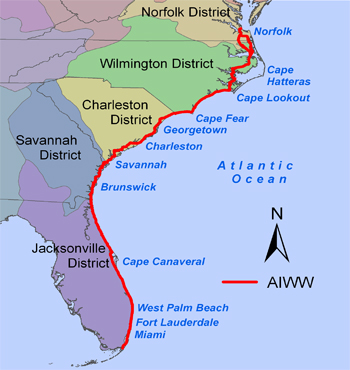
Photo: CruisersWiki
Since Florida has two coastlines (the Atlantic Ocean and Gulf of Mexico), it has the unique distinction of having two ICW sections. Along the East Coast, it’s simply the ICW. On the West Coast, the waterway is known as the Gulf ICW (GICW).
Florida’s Atlantic ICW begins at the St. Mary’s River at the Florida/Georgia border and runs to Key West. The Gulf side runs from Punta Rassa, near the Sanibel Island Causeway, to the Anclote River near Tarpon Springs.
Top Towns Along the Florida ICW
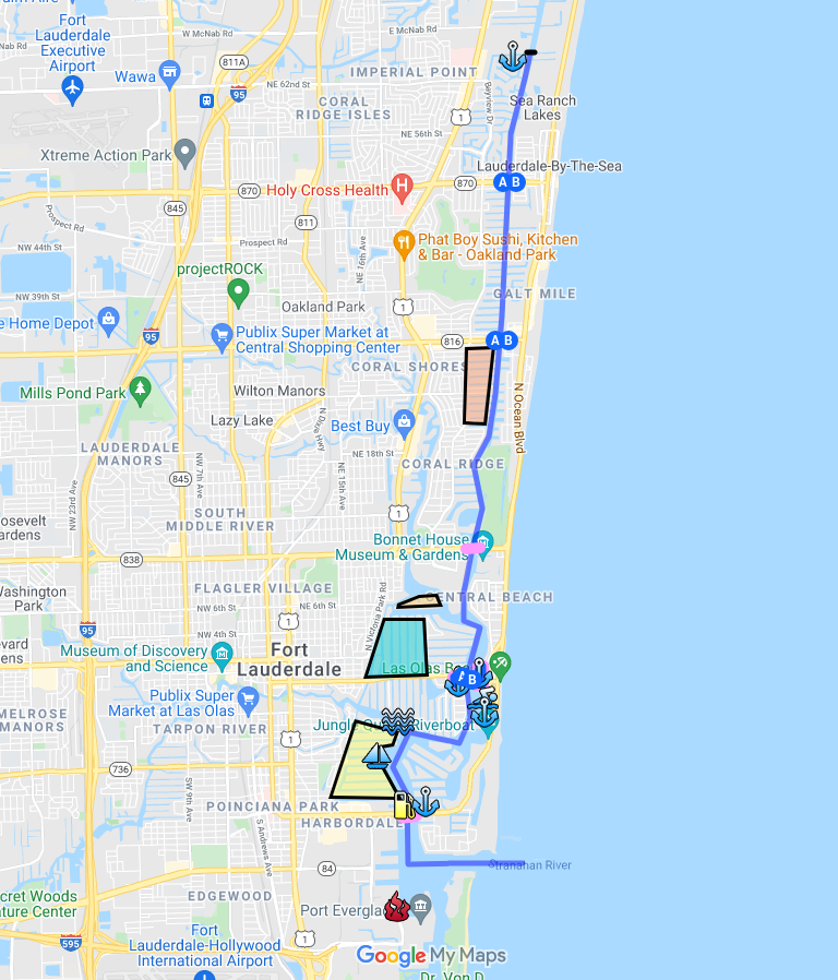
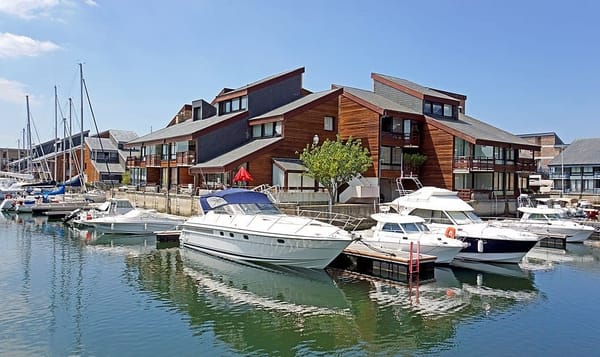
Fort Lauderdale ICW
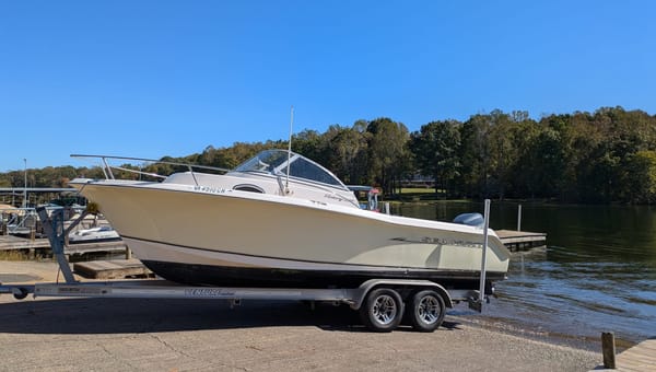
The Florida ICW flows past coastal towns, fun attractions, and scenic waterways. If you’re not in a hurry, it’s a terrific opportunity to take some time and explore. Book a private boat dock rental or toss out an anchor.
Atlantic Coast
- Jacksonville
- St. Augustine
- Daytona Beach
- Cocoa Beach
- Melbourne
- Vero Beach
- Stuart
- Jupiter
- West Palm Beach
- Pompano Beach
- Fort Lauderdale
- Hallandale Beach
- Miami
- The Florida Keys and Key West
Gulf Coast
- Marco Island
- Naples
- Fort Myers
- Sanibel
- Sarasota
- St. Pete Beach
- Tampa
- New Port Richey
- Tarpon Springs
- Apalachicola
- Carrabelle
- Panama City
- Destin
- Ft. Walton Beach
- Pensacola
Florida ICW Passage Routes
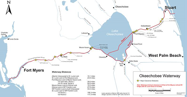
Photo: CruisersWiki
Traveling down the East Coast of Florida, you can take one of two routes: Lake Okeechobee or the Florida Keys. The Okeechobee Waterway extends from Stuart on the east coast (enter via the St. Lucie River) to Fort Myers (exit via the Caloosahatchee River) on the west coast. This route allows you to cut across the state rather than cruising all around the Keys. Once you reach Fort Myers, you can get into the Gulf ICW at Punta Rassa or take a break and hang out at a private boat lift rental for a few days.
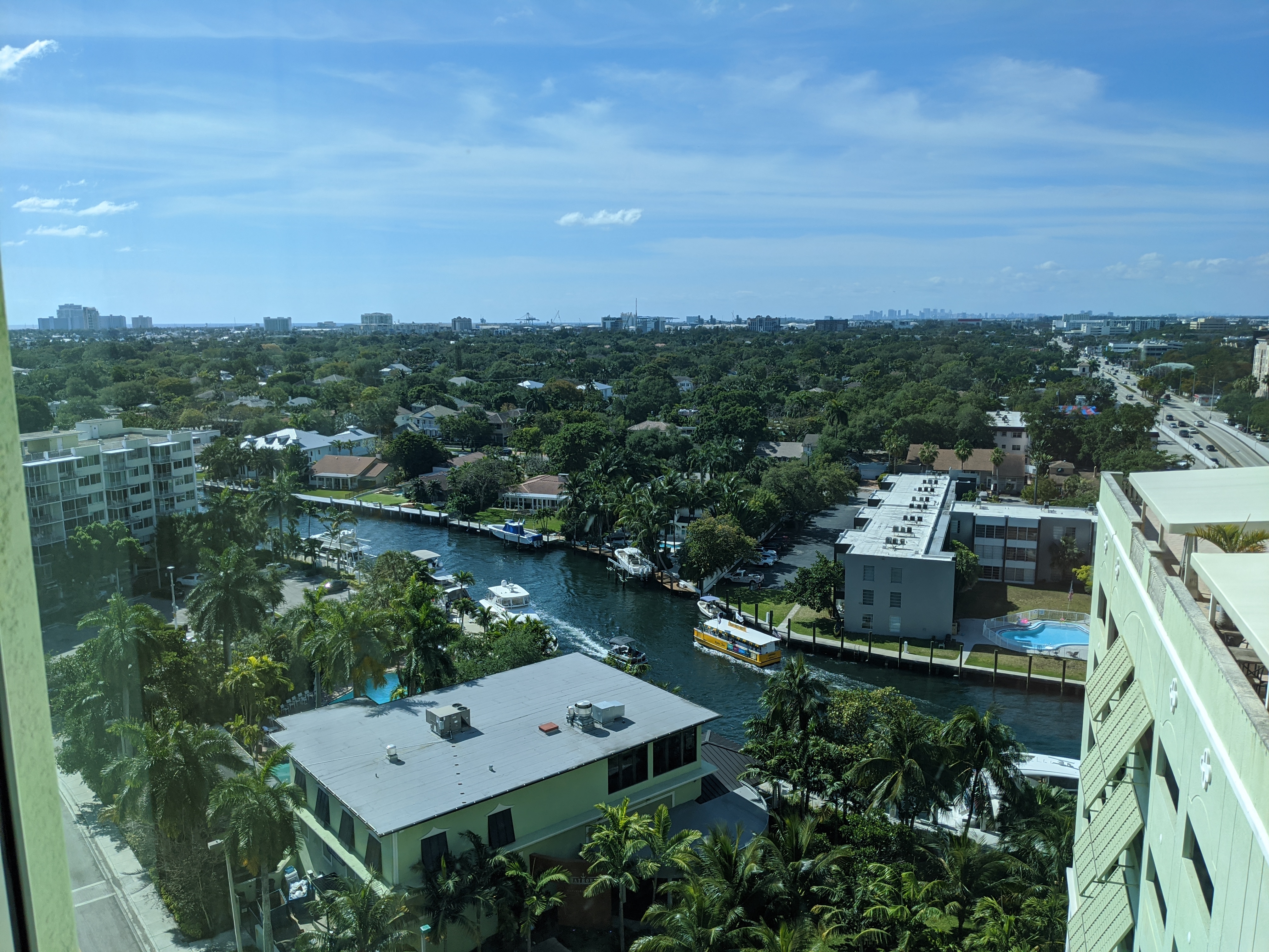
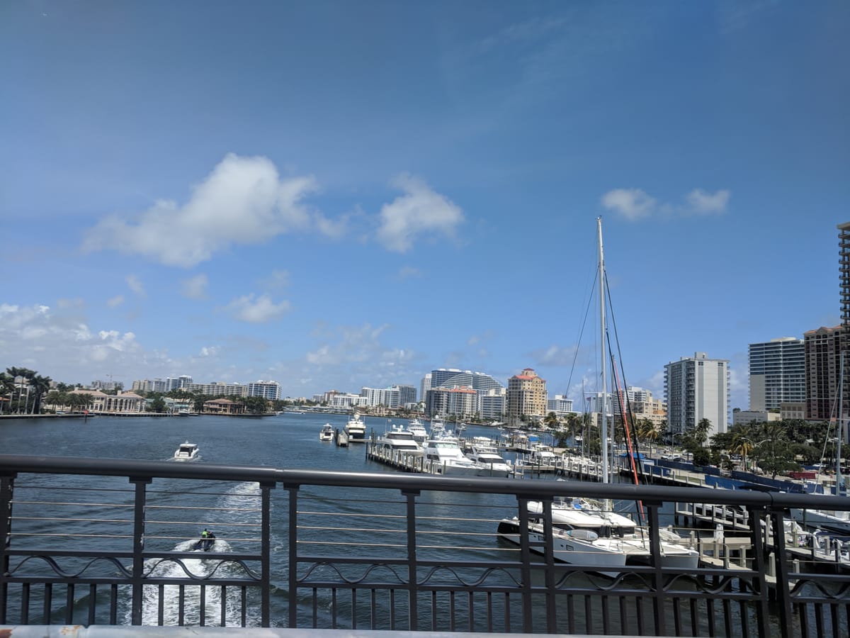
New River Views in Fort Lauderdale
The other route takes you all the way down the East Coast and along the Florida Keys and Key West. You’ll then enter the Gulf of Mexico. Keep going and you’ll connect with the GICW. Frankly, we like this version of the trip. The Keys are beautiful and offer crystal clear water, waterfront restaurants, historic attractions, private boat docks for rent and lots of other fun stuff.
Around Tarpon Springs, the GICW ends for a bit. It’s about 140 nautical miles to the next GICW point at Carrabelle, Florida. You can then take the ICW all the way to the far west end of the Panhandle at Pensacola.
Tips for Cruising the Florida ICW and GICW
Florida East Coast ICW
The ICW flows along the shoreline and intersects with other waterways. It’s important to stay alert for regular navigational markers and buoys.
There are yellow reflective squares and triangles in the ICW. They aren’t always on consistent sides of the waterway. The yellow squares are usually on the green beacons and buoys. Yellow triangles are usually on the red, but this isn’t always consistent.
There are navigational aids that are illuminated to bring notice to hazards (much like a lighthouse). If they’re blinking in quick blinks, you need to turn quickly.
Mile markers are measured in statute miles rather than nautical miles. These are on white signs with black numbers.
Range boards are large rectangular boards with three vertical stripes. They’re placed where cross currents and shallow water might be a problem. These will prevent you from running aground.
Channel depths can change so be aware of markers and signs.
The ICW has a lot of no wake zones. Watch your speed.
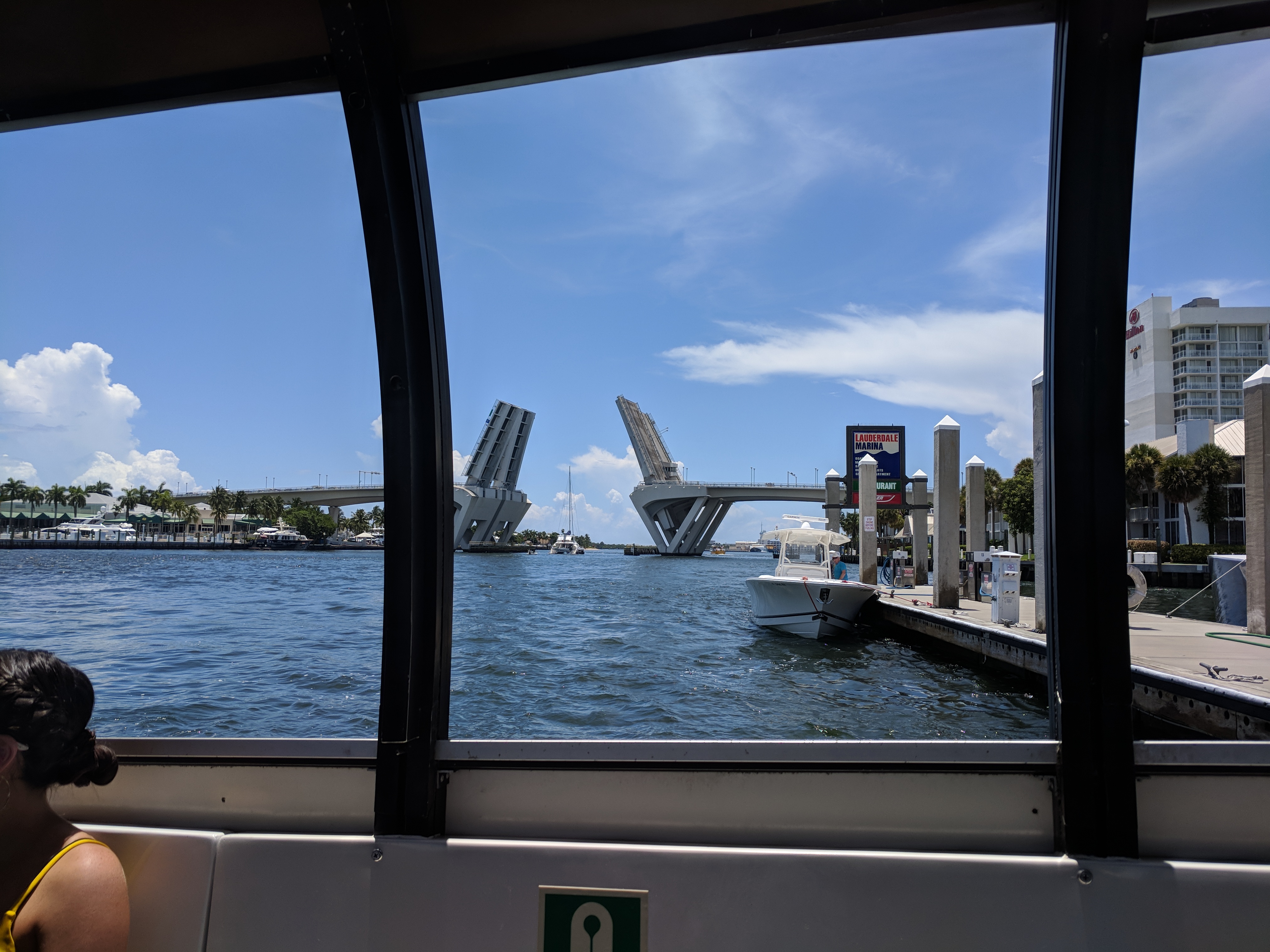
New River drawbridge, Fort Lauderdale
There are fixed bridges, drawbridges and power lines along the ICW. Most bridges along the Atlantic side are 65 feet. The Julia Tuttle Bridge in Miami, however, is 56 feet high. So, if your boat is taller than that, you’ll have to leave the ICW (near Port Everglades) and sail past Government Cut in Miami.
VHF channel 09 will alert you to hazards and bridge updates.
Florida GICW
Navigational aids on the Gulf ICW are the same as on the Atlantic side.
The GICW doesn’t have much to worry about as far as bridges and clearance. Three bridges have a clearance of 50 feet, but they’re not in an area where most boaters will be going. Power lines along the GICW have a clearance of 80 feet.
Whether you’re traveling in small sections of the ICW or taking the whole Florida loop, we hope you’ve gathered some tips for navigating the ICW. Let us know how it goes!