All About Tides: High, Low and Slack

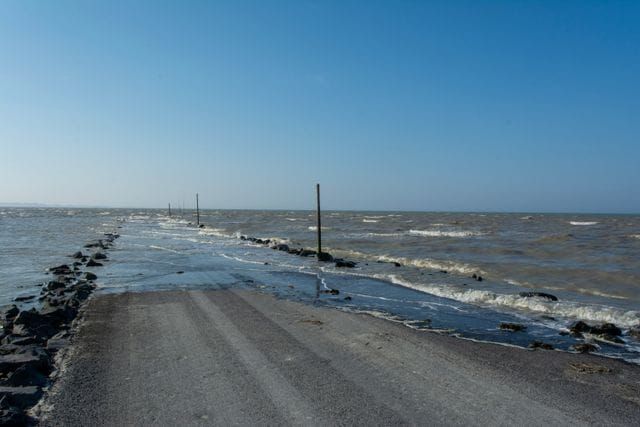
Tides influence nearly every aspect of boating, from navigating shallow channels and entering harbors to anchoring and planning a safe departure from a private boat lift rental or marina. Understanding how tides work helps boaters anticipate changing water depths, account for current strength and avoid running aground. While high and low tides describe changes in water level, slack water refers to a period when tidal currents temporarily slow or stop before changing direction.
Tides are primarily caused by the gravitational pull of the moon and sun, combined with Earth's rotation and the movement of ocean water. Although tidal patterns vary by location, understanding the differences between high, low and slack tides helps boaters make better decisions on the water.
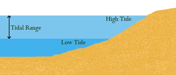
High Tide: When Water Levels Rise
High tide occurs when the water reaches its greatest height during a tidal cycle. In many coastal areas, two high tides occur approximately every 24 hours and 50 minutes, although some locations experience only one high tide or mixed tidal patterns.
High water can provide additional clearance for vessels navigating shallow channels, crossing sandbars or entering harbors with limited depth. It can also make certain anchorages and waterways accessible that might otherwise be too shallow.
However, high tide does not necessarily mean favorable boating conditions. Strong incoming currents may accompany rising water, particularly near narrow inlets, river mouths and constricted passages. These currents can affect steering, docking and maneuvering around other vessels.
Boaters should also remember that high tide does not always coincide with slack water. The water level may be at its highest while a tidal current is still moving.
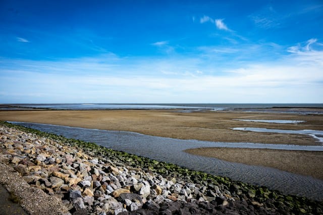
Low Tide: When Water Levels Recede
Low tide occurs when the water reaches its lowest level during a tidal cycle. As water recedes, shallow areas become more difficult to navigate, and previously submerged hazards may become exposed.
For boaters, low tide requires particular attention to charted depths, draft and under-keel clearance. A channel that offers adequate depth at high tide may become impassable for deeper-draft vessels several hours later. Sandbars, oyster beds, rocks and submerged obstructions may also become more hazardous as water levels fall.
Low tide can provide opportunities for activities such as beach exploration, shell collecting and inspecting certain coastal areas. However, boaters should avoid entering unfamiliar shallow waters without checking current depth information and predicted tidal levels.
When planning a passage, compare the vessel's draft with the charted depth and expected water level. Remember that charted depths are generally referenced to a designated vertical tidal datum, such as Mean Lower Low Water (MLLW) in many U.S. coastal charts. Actual water levels can differ from predictions because of wind, atmospheric pressure and other weather conditions.
Slack Tide: When Currents Slow or Stop
Slack tide, also called slack water, refers to the brief period when tidal currents slow considerably or temporarily stop before reversing direction. It typically occurs between the incoming and outgoing tidal flows.
During slack water, currents exert less influence on a vessel, making certain activities easier. Boaters may find it more manageable to navigate narrow channels, maneuver near docks, retrieve equipment or transit areas where strong currents create challenging conditions.
Slack water is particularly important in areas with significant tidal currents, such as inlets, river entrances and narrow passages. Divers and anglers may also consider slack periods when planning activities because reduced current can improve conditions.
Slack water, however, does not necessarily occur at the exact time of high or low tide. The timing depends on local geography, water depth, shoreline configuration and other factors. In some locations, there may be a noticeable delay between the time of high or low water and the reversal of tidal currents. Boaters should consult local current tables rather than assuming that slack water coincides with a predicted high or low tide.

Incoming and Outgoing Tides
Understanding the direction of tidal movement is just as important as knowing the water level.
- Incoming tide (flood current): Water moves toward shore or inland through an inlet, estuary or river mouth. Water levels generally rise during this period.
- Outgoing tide (ebb current): Water moves away from shore or seaward through coastal waterways. Water levels generally fall.
- Slack water: The transition period between flood and ebb currents, when tidal flow temporarily diminishes.
Incoming currents can help vessels travel toward certain destinations, while outgoing currents may assist a return trip. Currents can also create challenging conditions when they oppose wind or waves, producing steep and closely spaced seas.

Spring Tides and Neap Tides
The moon's position relative to Earth and the sun affects the range between high and low water. Spring tides occur around the new and full moons, when the gravitational effects of the sun and moon combine to produce a greater tidal range. High tides are generally higher, and low tides are generally lower than average.
Occurring about seven days after a spring tide, neap tides are a time of moderate tides when the difference between high and low is at the lowest. They occur around the first and third quarter moons, when the sun and moon exert their gravitational influences at approximately right angles. Their effects partially offset one another, producing a smaller tidal range.
These patterns are important for boaters navigating shallow waterways, where even modest changes in tidal range can affect available clearance.
Using Tide Tables for Trip Planning
Before departure from private boat docks for rent or marinas, consult local tide charts and current predictions for the intended route. NOAA Tides and Charts provides excellent information about expected high and low water, while current predictions identify the timing and strength of tidal flows at designated locations.
Consider the vessel's draft, channel depths, bridge clearances and expected current direction when selecting departure and arrival times at private boat slips for rent near me. Account for changing weather conditions that may cause actual water levels to differ from predictions.
High, low and slack tides describe different aspects of the tidal cycle, each with practical implications for boat operation. High tide provides greater water depth, low tide exposes shallow hazards, and slack water offers a temporary reduction in current strength. Understanding these differences helps boaters plan safer passages, navigate challenging waterways and make better use of changing coastal conditions.