Advanced Navigation: Using Radar, AIS, GPS and Paper Charts Together


Modern marine navigation systems provide boaters with an unprecedented amount of information. GPS can display a vessel’s position, AIS can identify and track other equipped vessels and radar can detect targets that may be difficult or impossible to see. Yet even with all this technology aboard, paper charts remain a valuable navigation resource.
The safest approach is not to rely on one system, but to understand how each tool works and use them together. Combining electronic and traditional navigation methods gives boaters multiple ways to monitor their position, identify hazards, anticipate traffic and recognize equipment errors. Check out a few of these tips before cruising out into the big blue from your private boat dock rental or local marina.
GPS: Establishing Your Position
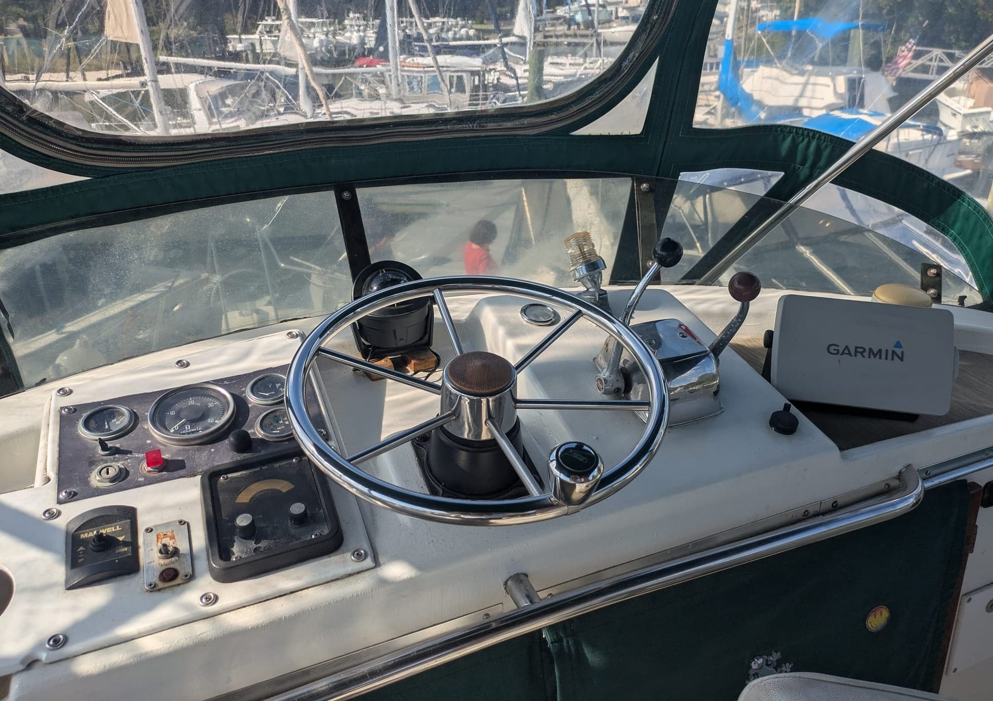
A GPS receiver determines a vessel’s position using signals from satellites. Modern chartplotters combine GPS data with electronic charts to show the boat’s location, heading, speed and planned route.
GPS is particularly useful for following a predetermined route, monitoring progress and identifying the boat’s position relative to channels, hazards and waypoints. It can also provide speed over ground and course over ground, which are useful for assessing changes in current and making navigation decisions.
However, GPS does not show everything around the boat. A chartplotter may display charted hazards, but it cannot independently determine whether another vessel is approaching or whether an uncharted object is floating in the water. GPS also depends on electronic equipment and satellite signals.
For these reasons, boaters should treat GPS as one source of navigation information rather than the sole authority for determining where the boat is and what lies ahead.
Radar: Seeing Beyond Visibility
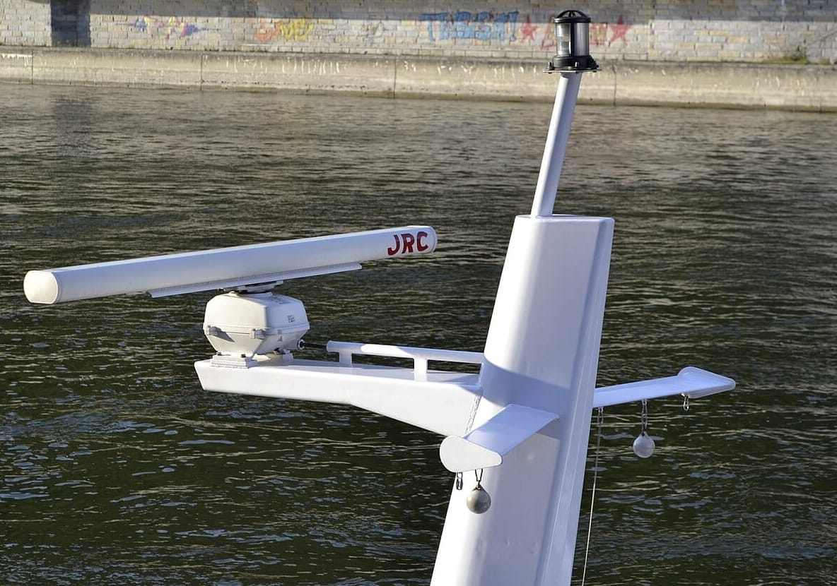
Radar transmits radio waves and analyzes their reflections to detect objects around the boat. Depending on the equipment, radar can identify land, vessels, buoys, structures and other targets, including in darkness, fog or heavy rain.
One of radar's greatest advantages is that it provides information about what is physically around the boat rather than relying on a digital chart. This makes it a useful cross-check against GPS and electronic chart information.
Radar requires interpretation, however. Not every radar return represents a navigational hazard, and some objects may produce weak or intermittent returns. Sea clutter, rain and nearby structures can also complicate the display.
Experienced boaters learn to compare radar targets with what they see visually, what appears on the chartplotter and information received through AIS. Using radar effectively requires practice, particularly in poor visibility or areas with heavy traffic.
AIS: Identifying Vessel Traffic
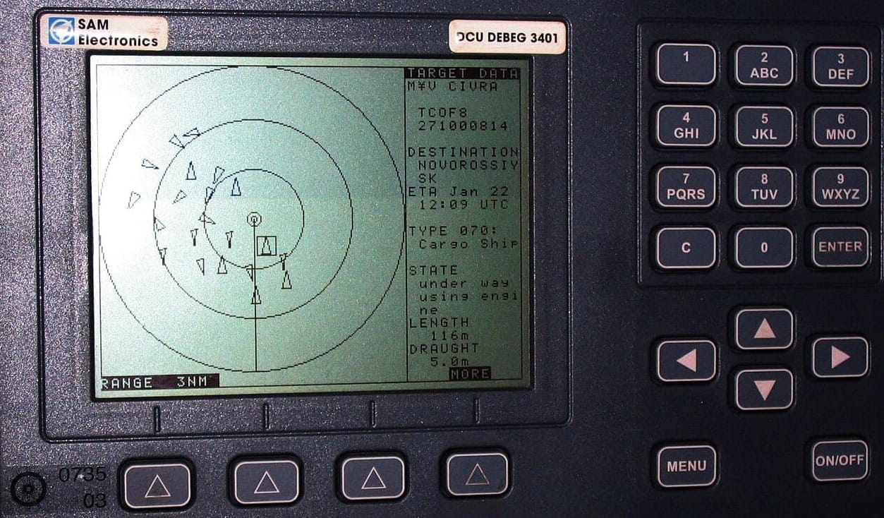
The Automatic Identification System (AIS) uses VHF radio signals to exchange information between equipped vessels and shore stations. Depending on the type of AIS equipment installed and the information transmitted by other vessels, a boater may see a target's name, position, course, speed and other data.
AIS is especially useful in busy waterways, near commercial shipping routes and during offshore passages. It can help boaters recognize a large vessel before it becomes visually apparent and determine whether its track may intersect with their own.
AIS has important limitations. Not every vessel carries AIS, and smaller recreational boats may not transmit AIS information. A vessel may also have equipment that is malfunctioning, improperly configured or not transmitting. AIS therefore should not be considered a substitute for radar or a proper lookout. A vessel that does not appear on AIS can still be present and pose a collision risk.
Paper Charts: The Independent Backup
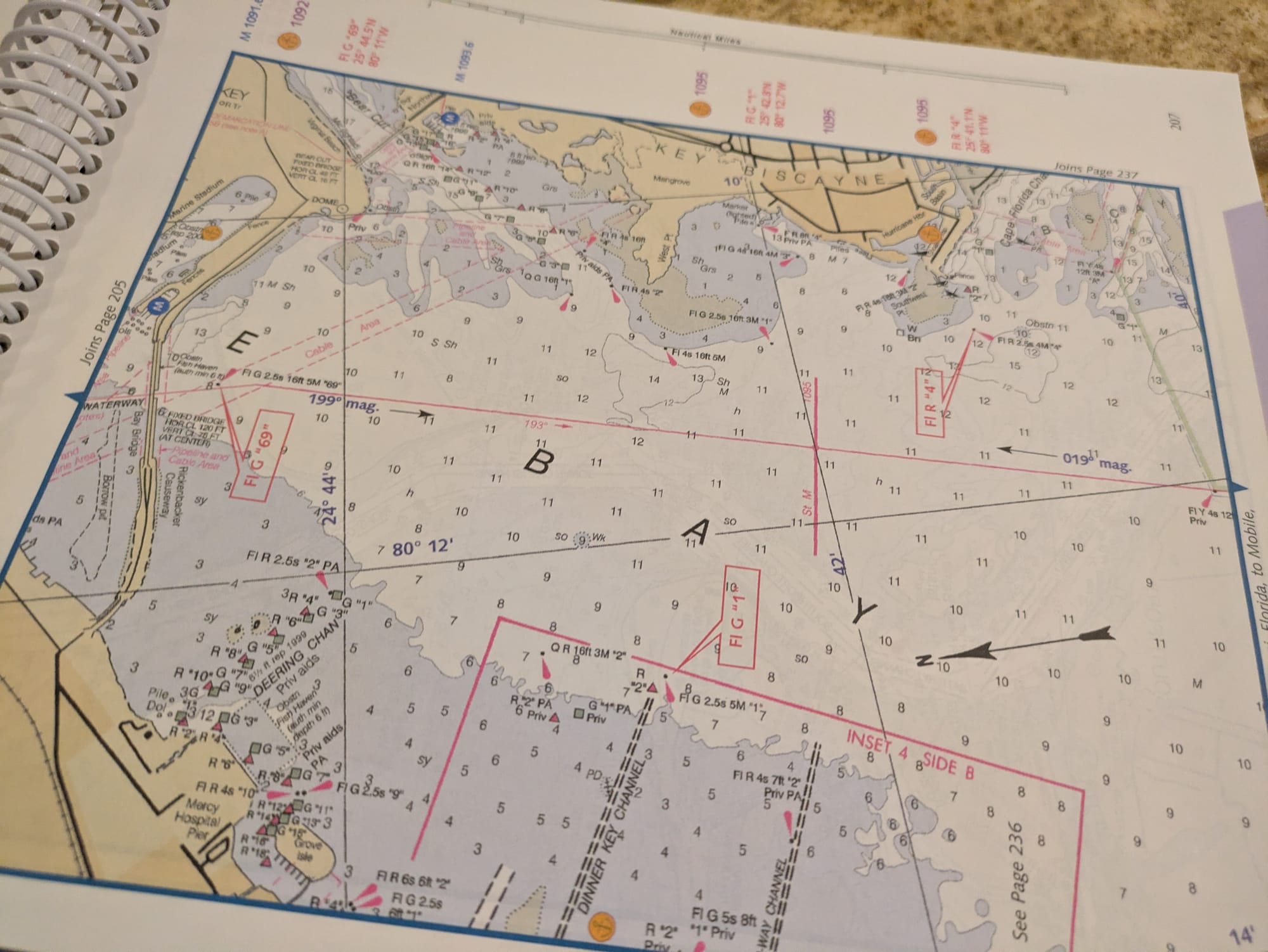
Paper charts provide a physical record of the waterways and surrounding geography. They show features such as depth contours, channels, aids to navigation, rocks, wrecks, shoals, restricted areas and other hazards. A paper chart also provides a useful independent reference when electronic equipment fails. A power interruption, damaged display, software problem or GPS issue can leave a boater without access to electronic navigation information.
Before departing from a marina or a private boat slip for rent, boaters should have appropriate paper charts for the intended voyage and know how to determine their approximate position using traditional navigation techniques. Depending on the circumstances, this can involve dead reckoning, visual bearings, compass headings and known landmarks.
Paper charts are not simply an emergency substitute for electronics. Comparing a paper chart with the electronic chart can also reveal differences in chart presentation, scale or data that deserve closer attention.
Putting the Systems Together
The greatest benefit comes from using the systems to verify one another rather than treating them as independent gadgets. For example, suppose a GPS chartplotter shows the boat approaching a channel entrance.
- The paper chart can be consulted to confirm the surrounding geography and hazards.
- Radar can then be used to locate the physical shoreline, buoys or other targets.
- AIS may identify commercial vessels operating nearby.
If the radar image does not correspond with the expected charted geography, the discrepancy deserves investigation. Similarly, if AIS indicates that a vessel is approaching but radar does not show a corresponding target, the situation should not automatically be dismissed. Differences in target size, range, radar settings, antenna position and environmental conditions can affect what appears on the radar display.
Using multiple systems also helps identify equipment errors. If the GPS position appears inconsistent with visual landmarks and radar, for example, the discrepancy is a reason to investigate rather than simply trusting the chartplotter.
Use the Compass as Another Cross-Check
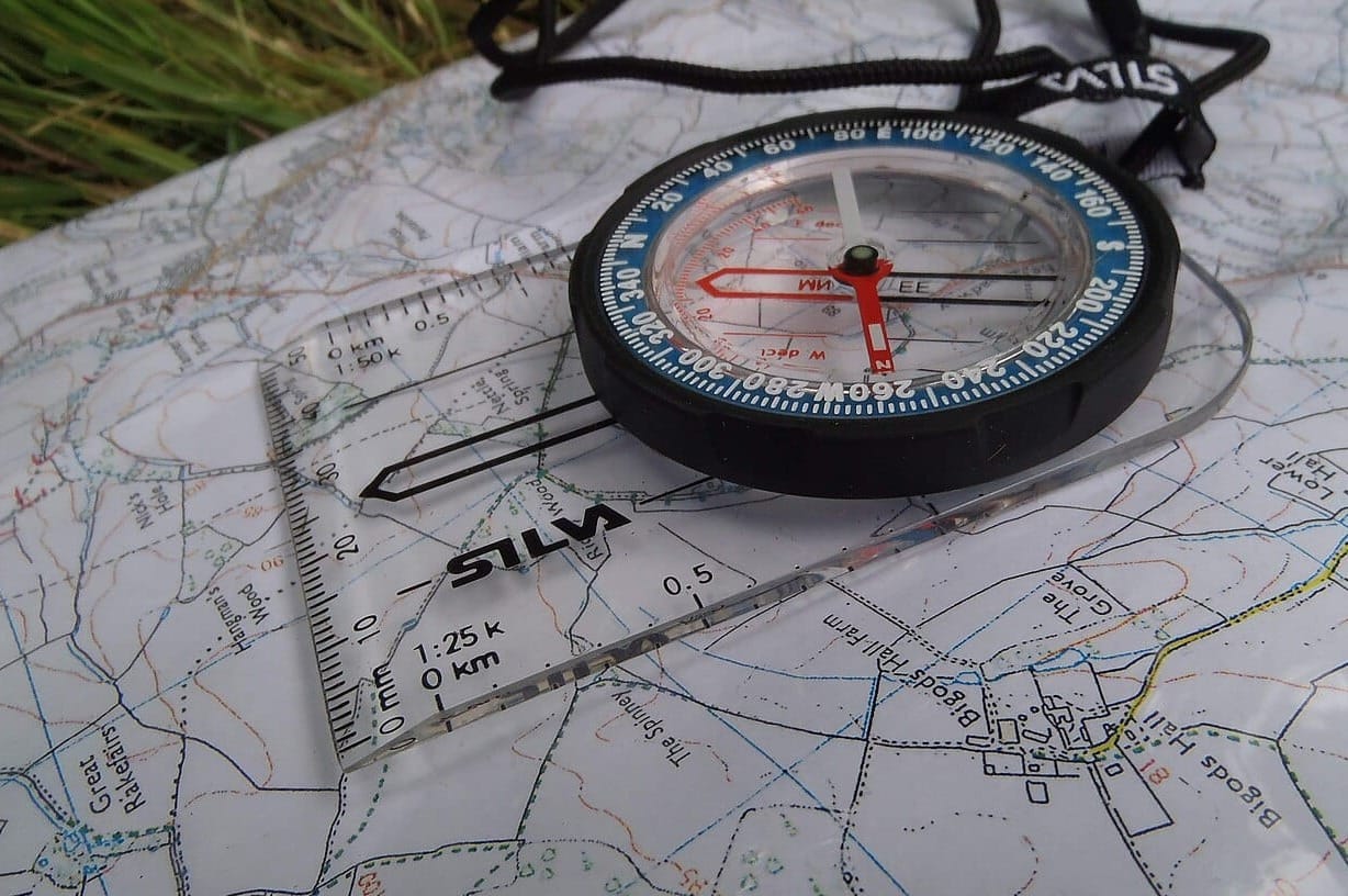
A magnetic or electronic compass provides another important layer of information. GPS can show course over ground, while a compass indicates the direction the boat's bow is pointing. Those figures can differ when wind or current causes the boat to move sideways through the water.
Understanding the difference between heading and course over ground is particularly important when navigating narrow channels or crossing areas with strong currents. A simple comparison among compass heading, GPS course over ground, radar information and visual references can provide a much clearer picture of what the boat is actually doing.
Practice Before Conditions Deteriorate
Advanced navigation is not simply about having sophisticated equipment. It is about knowing how the systems work, understanding their limitations and recognizing when their information does not agree.
Boaters should practice using radar, AIS, GPS, compass and paper charts during good visibility and familiar conditions while near a marina or private boat lift near me for rent. Learn how to establish a position on a paper chart, interpret radar returns, identify AIS targets and switch between different chart scales before those skills are needed in an emergency.
On a longer voyage, keep paper charts accessible rather than stored somewhere difficult to reach. Know how to operate navigation equipment manually if an automated route becomes unreliable, and maintain a written record of important waypoints, courses and hazards when appropriate.
Navigation Is a Process
The most valuable navigation system aboard a boat is not a particular piece of equipment. It’s the navigator's ability to collect information from several sources, compare it and recognize inconsistencies.
GPS provides position and movement data. Radar shows physical targets around the vessel. AIS supplies information about many transmitting vessels, while paper charts provide an independent overview of the waterways and hazards. A compass and visual observations add still more information.
Used together, these tools create layers of situational awareness. The goal is not to make navigation dependent on technology, but to use technology while retaining the skills needed to navigate when technology is unavailable or its information needs to be questioned.